DualCAD Spatial v.1.0
Advertisement
Description
The DualCAD project is an ongoing project 'over 17 years' to create a freeware cad application that handles the basic needs of most microstation users. Currently DualCAD is aimed at the 2D user with perhaps rotated views , reference files, and hybrid raster files. DualCAD can be run under LINUX using WINE. For more advanced CAD needs please look at PcsCustom. DualCAD Review is for redlining only. DualCAD is a 100% Microstation editor developed...
Read more
- Rate:
- Release Date:11/26/2011
- License:Freeware
- Category:Multimedia & Graphic Design
- Developer:Pangaea CAD Solutions
- Downloads:98
- Size:7.59 Mb
- Price: Free
To free download a trial version of DualCAD Spatial, click here
To visit developer homepage of DualCAD Spatial, click here
Advertisement
System Requirements
DualCAD Spatial requires Windows.
DualCAD Spatial v.1.0 Copyright
Shareware Junction periodically updates pricing and software information of DualCAD Spatial v.1.0 full version from the publisher using pad file and submit from users. Software piracy is theft, Using crack, password, serial numbers, registration codes, key generators, cd key, hacks is illegal and prevent future development of DualCAD Spatial v.1.0 Edition. Download links are directly from our publisher sites. Links DualCAD Spatial v.1.0 from Bittorrent, mediafire.com, uploadfiles.com, hotfiles.com rapidshare.com, megaupload.com, netload.in, storage.to, depositfiles.com and other files hosting are not allowed. The download file is obtained directly from the publisher, not from any Peer to Peer file sharing applications such as Shareaza, Limewire, Kazaa, Imesh, eDonkey, eMule, Ares, BearShare, Overnet, Morpheus, BitTorrent Azureus and WinMX.
Review This Software
More DualCAD Spatial Software
Advertisement
SuperGIS Spatial Statistical Analyst v.2.0
SuperGIS Spatial Statistical Analyst is a set of application software integrating geostatistical methods and GIS functions.
Dualcad v.2 93
The DualCAD project is an ongoing project 'over 17 years' to create a freeware cad application that handles the basic needs of most microstation users.
C# Spatial Index (RTree) Library v.1
The C# RTree project aims to maintain a C# version of the RTree spatial indexing algorithm.
Java Spatial Index (RTree) Library v.1.0b8
The Java RTree project aims to maintain an Java version of the RTree spatial indexing algorithm.

Spatial Knowledge Base v.2.1.3
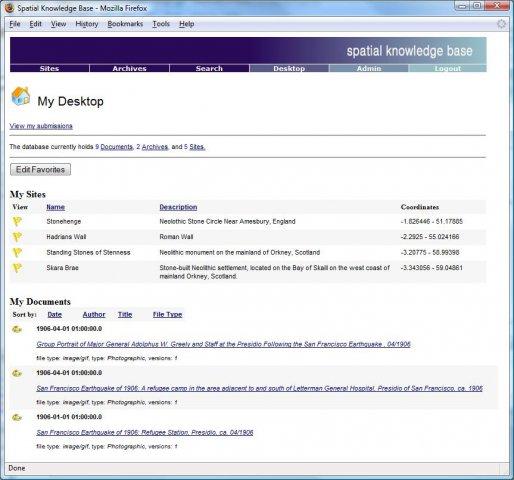
Spatial Knowledge Base is a web based application for storing and searching of archaeological sites information.
Spatial Mp3 player v.1
Spatial Mp3 Player is a fast Flash mp3 player.
CHIP Spatial/Temporal Cluster Generator v.1.0
The CHIP Cluster Generator attempts to create spatio-temporal cluster data in an automated fashion to help evaluate epidemic detection software.

SpatialNote v.PublicBeta
SpatialNote is a web-based 3D note-taking and knowledge sharing tool that boost your memory and learning process by engaging spatial mechanisms. SpatialNote doesn't require any special 3D or graphic skills.
SADA v.4. 1. 1950
Spatial Analysis and Decision Assistance (SADA) is free software that incorporates tools from environmental assessment fields into an effective problem solving environment.
Geographic Imager v.3 1
Working with raster imagery doesn't have to be complicated. Geographic Imager® enhances Adobe Photoshop to make working with spatial imagery quick and efficient.
Other products of this developer Pangaea CAD Solutions
Dualcad v.2 93
The DualCAD project is an ongoing project 'over ...dles the basic needs of most microstation users.
